
Well Marked Low Pressure Giving Heavy Rain To North Madhya Maharashta, MP & UP
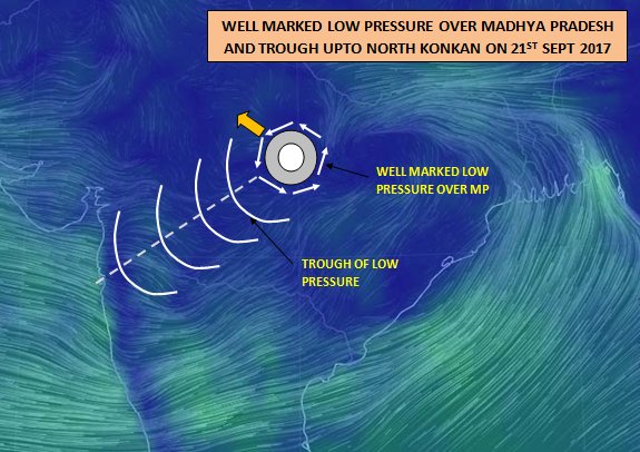
In continuation with earlier post about low pressure over Chhatisgarh, this low has intensified into a well marked low which is located over Madhya Pradesh. It has formed a strong trough (a belt of low pressure) having extension upto North Konkan (as shown in picture). Click here to see the simulation model.
Due to the well marked low’s extension is upto deep west it is getting moisture from Arabian sea. This is the reason why North Konkan including Mumbai and districts of North Madhya Maharashtra were vulnerable and receiving moderate to heavy rain on since night of 20th Sept 2017.
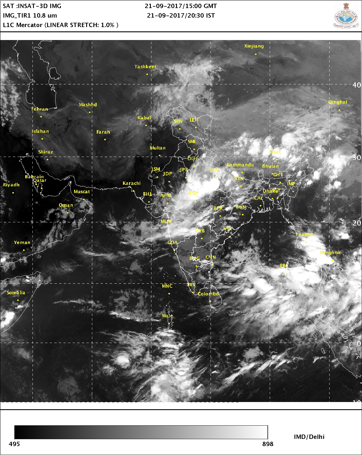
The presence of trough shown can be seen in the satellite picture below:
Tomorrow and day after tomorrow that is 22nd & 23rd Sept, its turn of North Madhya Pradesh and West Uttar Pradesh to receive heavy to very heavy rain.
Anticyclone of West Rajasthan may not allow this system to move further and hence West Uttar Pradesh may be rich enough to get rain for three days. West Uttar Pradesh is rain deficit by 36 %.
The Well Marked Low is at Central Madhya Pradesh and will give tremendous rainfall to West Madhya Pradesh adjoining districts of dists of North Madhya Maharashtra.
Akola Jalgaon Buldhana Nandurbar are the districts to get rain tonight on 21st Sept and tomorrow 22nd Sept.